Sector 15 Part I, Gurgaon: layout map
Every plot in Sector 15 Part I, numbered — 685 of them — with 14 parks, the schools and the road widths, drawn from the layout plan HSVP publishes. Type a plot number on the map to find it.
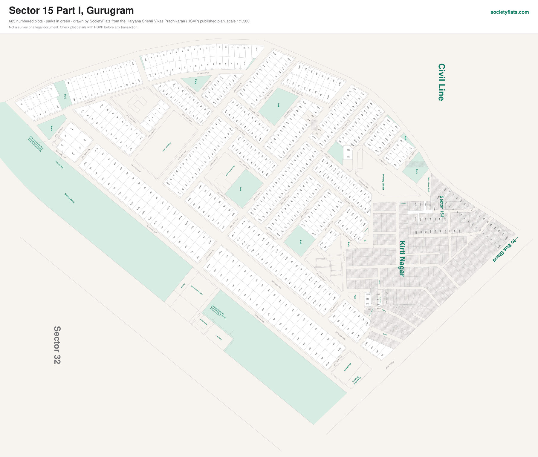
On the plan: HUDA, Land, Park, Street, Kirti Nagar, Shri Raghunath Mandir, Vacant Area, Primary School, Radha Krishan Mandir, Rest House, Convenient, Shopping, Cng Station, Petrol Pump, Lawn Tannis Ground, Passage, Civil Line, ←to Bus Stand, Community Centre, Shopping Centre, HUDA Land, Ctp/stp/(n)/km 297 Dt., 13-01-2010 (drg No. Dtp (g), 1865 2009 / Dt 15-06-2009).
Next to Sector 32.
Source: the Sector 15 Part I layout plan published by HSVP, scale 1:1,500. Plot sizes are measured from the drawing and approximate. Not a survey or a legal document — check a plot's details with HSVP before any transaction.
Other sector maps: Sector 9 · Sector 10A · Sectors 15 Part II & 16 (part) · Sector 42 · Sector 43 · Sector 45 · Sector 46