Sector 5, Gurgaon: layout map
Every plot in Sector 5, numbered — 1,299 of them — with 20 parks, the schools and the road widths, drawn from the layout plan HSVP publishes. Type a plot number on the map to find it.
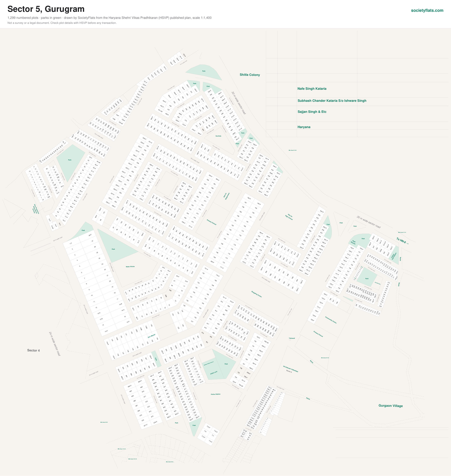
On the plan: Water Works, Park, Gurgaon Village, To HN-8 →, Site for, Dispensary, Primary School, Sucheta, High School, Shopping Centre, Police Station, Staff, Quarter, 222ap, 222jp, Indoor, Sub Station, Community Centre, Sd Adarash Vidhyalaya, Xion Progresive, Educational, Society, Salwan Public School, Shitla Colony.
Next to Sector 4, Sector-6.
Source: the Sector 5 layout plan, published by HSVP, scale 1:1,400. Plot sizes are measured from the drawing and approximate. Not a survey or a legal document — check a plot's details with HSVP before any transaction.
Other Gurgaon maps: Sectors 1, 2 & 3 · Sector 4 · Sector 7 · Sector 9 · Sector 9A · Sector 10 · Sector 10A · Sectors 12, 6 (part) & 13 · Sectors 12A, 6 & 13 (part) · Sector 14 · Sectors 15 Part II & 16 (part) · Sector 15 Part I · Sector 18 · Sector 21 · Sector 22 · Sector 23 · Sector 23A · Sectors 24 & 25A · Sector 27 · Sector 28 · Sector 29 · Sector 30 · Sectors 31 & 32A · Sectors 33 & 34 · Sector 37 Part I · Sector 37 Part II · Sector 37C · Sector 38 · Sector 39 · Sector 40 · Sector 41 · Sector 42 · Sector 43 · Sector 44 · Sector 45 · Sector 46 · Sector 47 · Sector 48 · Sectors 49 & 50 · Sector 51 · Sector 52 · Sectors 52A & 53 · Sector 54 · Sectors 55 & 56 · Sector 57 Part I · Sector 57 Part II